History
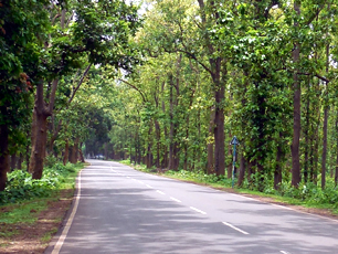
 Jhargram is a Sadar Sub-divisional Municipality situated in the middle part of Jhargram District of West Bengal, India. Jhargram offers the most exotic beauties of undulating topography culminating in hill ranges of Belpahari, Kankrajhor in the North to the serene beauties of meandering Subarnarekha River in the South. Jhargram is the paradise of nature lovers with bountiful forests of Sal, Mahul, wild elephants, deer and birds. The ancient tenples, royal palaces, folk tunes and rhythms of tribal make it all the more attractive destination of tourists who love to discover the unknown and unaffected beauties of nature.
Jhargram is located at 22.450N, 86.980E. It has an average elevation of 81 metres (265 feet). Usually the weather like much of Bengal is extremely humid and tropical. Temperatures can reach as high as 460C in the hot and dry months of May and jine but can plummet to about 40C in the chilly night of December and January.
Surrounded by dense Sal and Mohua trees and carpeted in red earth, Jhargram, is jan ideal destination for spending a few days in tranquility, on a comparatively low cost budget. Situated in West Bengal and quite close to the Jharkhand State, Jhargram shares its culture with both states. Winter in Jhargram is very enjoyable.
As of 2011 India census, Jhargram had a population of 61,682. Males constitute 50.17% of the population and females 49.83%. Jhargram has an approx. Average literacy rate of 81%. At a Glance
Basic Information
Location:Jhargram town is located on Howrah-Mumbai railway rail way line and 155Km away from Kolkata and only 20 km away from the border of Jharkhand State and 36 km away from District Headquarter, Midnapur and 15Km away from N.H.-6.
Area:
Total area of the town is 21.40 Sq. Km. The town expanding in such a way that it is very difficult to identify the Panchyet area and Municipal area at the outskirts in three sides. Now there are 18 wards in the Municipality.
Population:
According to draft census report of 2011 it appears that population of the town was reached to 61682, and there is a trend to influx from the nearest villages of the town as well from abroad due to availability of Medical aids, Education & Marketing facilities. There is huge gathering of people every day from all parts of the Sub-Division and neighboring states to get the above facilities and official works which automatically increasing the demand of water supply, sanitation road facility conservancy expansion of markets and other municipal services – the decadal variation of the town population has always shown in considerable high which may be seen from the beside tables.
Climate & Rainfall:
The climate is hot and humidity is high mainly three seasons are visible in the town and its adjacent area. These are summer monsoon and winter. Summer season is persistently long one. It lasts for seven to eight months of a year. And during this season the town faced severe water scarcity when wells and ponds are dried up and people depend upon municipal water supply. Town is situated in the drought prone region. Average annual rainfall is 1000mm., which is much lower than the other part of the district.
Soil:
The major parts of the town is covered by laterite soil, the ages of which is difficulty to ascertain. Facets of alluvial deposit are found in the northern part. The Normal colour of the soil reddish-brown.
Administrative Setup:
Jhargram town is the Sub-Divisional Headquarter of Jhargram Sub-Division comprising of eight blocks and nine Police Stations. Jhargram town achieved its municipal status in 1982 adopting 25 mouzas of Jhargram Panchayet Samity. There are 18 (Eighteen) Wards of the municipality with one councilor each ward.

